Road Damage Monitoring WebGIS
A digital map-based road damage reporting and monitoring platform.
Context
Road maintenance requires accurate, up-to-date damage location data so responses are well-targeted.
What We Built
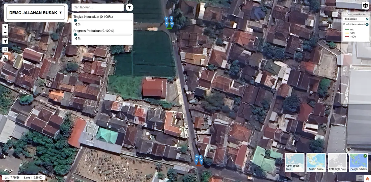
We built a digital map-based platform for road damage reporting and monitoring, making it easy to record damage points and their handling status.
Damage points are recorded at their coordinates rather than as an address description another officer has to reinterpret. Each point carries its handling status, so reports already acted on are clearly separated from those still waiting.
The fundamental difference from form-based reporting is being able to see distribution. Once damage is drawn on a map, patterns surface: which stretches fail repeatedly, and whether the problem is spread out or concentrated on particular segments. That pattern does not emerge from a list.
Key Features
- Damage point reporting on the map.
- Handling-status monitoring.
- Centralized database for maintenance planning.
Results & Impact
Decision-makers gain a spatial view of road conditions.
The value shows up in prioritisation. Maintenance budgets are always limited, and a map lets choices rest on recorded distribution and severity rather than on which report arrived first.
The system also retains history: stretches reported damaged repeatedly can be identified, which often signals a construction or drainage problem rather than ordinary wear. The same pattern of needs applies to other dispersed assets — see our WebGIS development service.