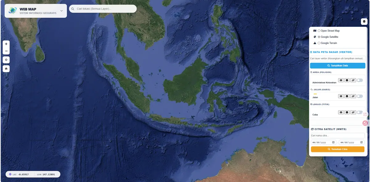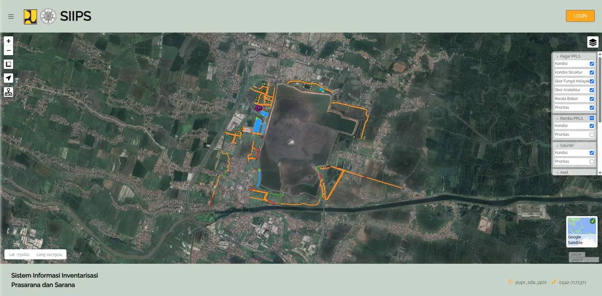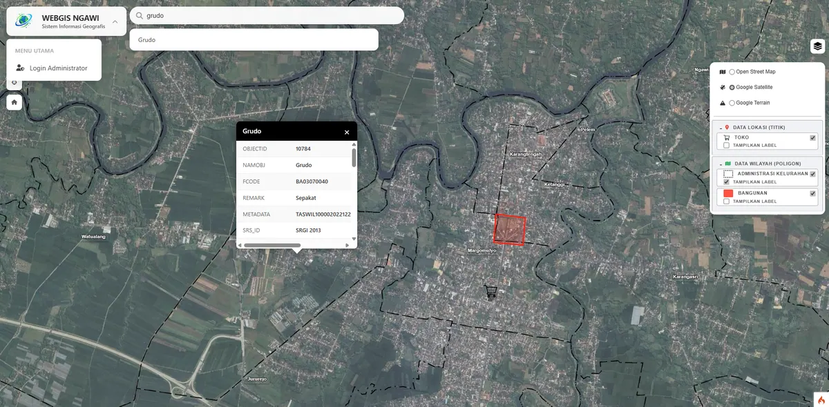
OGC-Standard Geoportal Services (GeoServer WMS/WFS)
Manage and publish large-scale spatial data through interoperable, OGC-standard geoportals (WMS/WFS/WMTS) ready to connect with other systems.
Large-Scale Geoportals on Open Standards
When your spatial data grows massive and must be shared across systems or institutions, closed standards become a bottleneck. We build GeoServer-based geoportals that expose OGC-standard services — WMS, WFS, WMTS, and WCS — so your data can be consumed by QGIS, ArcGIS, web apps, or third parties without vendor lock-in.
The OGC (Open Geospatial Consortium) sets the open standards for exchanging geospatial data. The core idea is simple but consequential: instead of emailing a shapefile every time something changes, you publish one service endpoint. Anyone authorised adds that endpoint to their GIS software and always sees the current version.
Understanding OGC Services: WMS, WFS, WMTS, and WCS
These four are often named together, yet they do different jobs — and picking the right one determines both the performance and the cost of your system.
WMS (Web Map Service)
WMS delivers maps as images. The server renders on its side and sends PNG or JPEG tiles to the client. Because only an image travels, the client never receives the underlying geometry or attributes — it cannot measure, edit, or filter the data independently.
Use WMS when you need to display layers that are expensive to render — thousands of parcel polygons, or satellite imagery — and users only need to look at them. WMS is also the safest way to share a view of your data without handing over the data itself.
WFS (Web Feature Service)
WFS delivers vector features with their attributes rather than images. The client receives the actual geometry — points, lines, polygons — as GML or GeoJSON and renders it itself. That difference determines what users can do: with WFS they can select features, read every attribute, run spatial analysis, measure distances and areas, and filter with queries.
WFS also supports server-side filtering, so a client can request just a subset — parcels in one village, say — instead of downloading the whole layer. The WFS-T (transactional) variant goes further and lets clients write back: adding, editing, and deleting features directly from QGIS.
The practical trade-off: WFS is more resource-hungry than WMS because it ships raw data, and it does not suit very large layers without filtering. But WFS is the only way other institutions can genuinely use your data rather than merely view it.
WMTS (Web Map Tile Service)
WMTS is WMS optimised through pre-rendering. The map is cut into tiles at predefined zoom levels and cached. Because the server never re-renders on request, WMTS is far faster and handles many concurrent users comfortably. The cost is flexibility: styling is fixed at cache-build time, and data updates require rebuilding the cache.
Choose WMTS for basemaps and rarely-changing layers that are accessed often. Choose WMS when data updates frequently or styling must stay dynamic.
WCS (Web Coverage Service)
WCS serves raster data as values, not pictures. Where WMS sends an already-coloured image, WCS sends the original pixel values — elevation in metres from a terrain model, or per-band reflectance from satellite imagery. This is what you need when the recipient intends to compute rather than look: slope analysis, vegetation indices, or land-cover change over time.
Capabilities
- Publish vector & raster layers via OGC-standard WMS/WFS/WMTS/WCS.
- Efficient time-series raster management (e.g. multi-temporal imagery).
- Consistent metadata catalog and layer styling (SLD).
- Tile caching (GeoWebCache) for fast map access performance.
- Per-layer and per-service access control aligned with your policies.
- PostGIS as the primary store, not a pile of files.
GeoServer + PostGIS Architecture
The stack we use has three layers. PostGIS stores spatial data inside PostgreSQL, with spatial indexes that keep area queries fast as data grows. GeoServer sits above it, translating database content into OGC services and handling rendering, styling, and caching. At the outermost layer, the web application consumes those services through Leaflet.js or OpenLayers.
This separation is what distinguishes a geoportal from an ordinary WebGIS: database, services, and interface can evolve independently. You can replace the interface without touching the data, or add new consumers without changing anything server-side.
One cost implication deserves to be stated plainly: GeoServer is a Java application that needs dedicated memory, so it requires a VPS rather than shared hosting. If no third party will actually consume your OGC services, the lighter non-GeoServer WebGIS architecture is usually the wiser call.
Benefits
Full interoperability, freedom from vendor lock-in, and scalability for ever-growing data. Ideal for agencies, regional geoportals, and cross-department data integration. If your data is still scattered across formats and coordinate systems, we handle that preparation as spatial data integration.
Frequently Asked Questions
What is the main difference between WMS and WFS?
WMS sends the map as an image already rendered by the server, so the client can only look at it. WFS sends the original vector geometry with its attributes, so the client can select features, read attributes, measure, filter with queries, and run spatial analysis. As a consequence WFS is more resource-intensive, but it is the only way others can genuinely use your data rather than merely view it.
Does a geoportal have to use GeoServer?
Not necessarily. GeoServer is needed when you genuinely have to publish OGC-standard services so other systems or institutions can consume your data directly. If the data is only used by your own application, a non-GeoServer architecture is lighter, runs on ordinary hosting, and is much cheaper to maintain. We will tell you plainly if your requirements do not yet call for GeoServer.
Can geoportal data be opened directly in QGIS or ArcGIS?
Yes — that is the whole point of the OGC standards. Users simply add your WMS or WFS endpoint to QGIS or ArcGIS, and your layers appear like local data, always showing the current version. No more emailing a shapefile every time something changes.
Can GeoServer run on shared hosting?
Generally no. GeoServer is a Java application that needs a dedicated memory allocation and the ability to run its own service, so it requires a VPS or dedicated server. This is one reason the Geoportal package costs more than a non-GeoServer WebGIS. VPS costs are excluded from our quote so the server account stays in your own hands.
How do you handle multi-temporal satellite imagery?
GeoServer supports a time dimension on raster layers, so imagery from several dates can be stored as one layer that can be stepped through over time. Combined with tile caching, browsing between periods stays responsive. If the recipient needs to compute — vegetation indices or land-cover change, for example — we also publish through WCS so what travels is the original pixel values, not an already-coloured image.